The Santa Cruz River Headwaters
Introduction

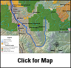
The headwaters of the Santa Cruz River wind through the San Rafael basin – a broad, north-trending valley surrounded by block-fault mountains. This basin – bounded on the west by the Patagonia Mountains, on the north and east by the Canelo Hills, and on the south by the International Boundary with Mexico – is a high, semi-arid desert grassland. Elevations range from 4,600 to 5,100 feet above mean sea level in the Patagonia Mountains to 6,170 feet above mean sea level in the Canelo Hills. The headwaters support a lush, riparian ecosystem that is surprisingly undisturbed, despite its rich history.
The Santa Cruz originates in the Basin and Range region of southern Arizona, then flows south toward Mexico. Beginning about five miles north of the International Boundary near Lochiel, the river becomes perennial for about a two-mile reach. The remainder of the Santa Cruz River within the basin is ephemeral. After making a 35-mile loop through Mexico the drainage crosses back into the United States near Nogales.
Ecological Importance
The Santa Cruz Valley contains several stretches of natural river flow, important riparian and grassland habitats, unfragmented wildlife migration corridors, and diverse plant and animal communities, including numerous endangered species. The river flows on the surface through much of the upper valley in the San Rafael Valley and Sonora, supporting many native and migratory species. The ephemeral reaches support some woody riparian vegetation of mostly cottonwood and willow; density and diversity increase as the river progresses southward toward the perennial section.The valley supports some of the greatest diversity of mammal species in North America, including black bear, bobcat, coyote, and mountain lion. White-tailed deer, mule deer, and javelina are common, and pronghorn antelope were reintroduced to the valley in the 1950s. The river basin offers good habitat for the Mexican gray wolf, extirpated from Arizona until recent reintroduction efforts.
An abundance of birds inhabit the valley, and waterfowl migrate through in the spring and fall. The northern goshawk, a rare woodland raptor, occasionally hunts for birds and rodents in the foothills.
The valley harbors two federally endangered plants — Huachuca water umbel and Madrean ladies'-tresses—as well as the rare Wilcox fishhook cactus. The endangered Gila topminnow, thought once to be one of the most common fish in southern Arizona and the Gila chub, a federal candidate species, cling to survival in the perennial segments of the river, as do several sensitive species of frogs and reptiles. The endangered Sonoran tiger salamander is endemic to the San Rafael Valley.
Human History:
The Tohono O’odham tribe inhabited the valley when Spanish settlers established the first European colonization in Arizona. The area became part of the United States with the Gadsden Purchase in 1853. In the late 1800s continued arrival of settlers who depended upon water from Santa Cruz significantly altered the ecosystem.
Conservation:
Over 40,000 acres of unique grassland and desert habitats in the valley are protected by a cooperative effort by the Nature Conservancy and Arizona State Parks. The San Rafael Ranch Natural Area is not currently not open to visitation, due to safety concerns along the border with Mexico.
Contributing Writers
Bob Sejkora and Jeri Ledbetter.
Photo © Jeri Ledbetter
Links
Water Resources
USGS Stream flow and water quality data
USGS Real-Time Water Data, Santa Cruz River near Lochiel, AZ
Biological Information
Riparian inventories U.S. Fish and Wildlife Service
Threatened and endangered species in Arizona
Conservation
http://www.pr.state.az.us/Parks/parkhtml/sanrafael.html
Bibliography
- Arizona Water Resources Assessment, Volume II Hydrologic Summary, Hydrology Division, Arizona Department of Water Resources, 1994.


